2017 California Trip — Our Fifth Day in California

Our fifth full day in California, we left the Pasadena/Los Angeles area once again to visit our annual national park. This year, we went to Joshua Tree National Park (which is another topic to spend an entire post on). And my bank did not like this day, like, at all. You see, I forgot to tell them that I was going to California and the algorithm was able to cope okay with expenses in Los Angeles, Burbank, Pasadena, San Pedro, Malibu, and so on. For some reason, however, it couldn’t cope with my buying gas in Morongo Valley or a t-shirt or pretzel rods in Twenty-Nine Palms. Fortunately my debit card went through for all of those purchases, but when I got home, I had an email from my bank asking about it. And, yes, it was from my bank. I called the phone number on the back of my debit card.

We actually got out reasonably early, at 8:00 in the morning, though I had hoped to leave at 6:00 or 7:00. We stopped at the Walmart in Glendora for the only concession I made to the fact that we were going to spend the day in the desert. I bought — and then actually applied — a fairly high SPF (or whatever they’re calling it these days) sunblock (spoiler: I also did kind of a lousy job and ended up with a streaky, blotchy sunburn).

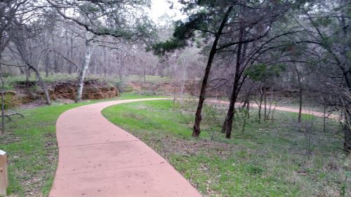
We then headed off to Joshua Tree. After a bathroom stop at a rest stop and stopping in Morongo Valley for gas, we arrived at Joshua Tree about three hours later. This meant, of course, that we were in the desert for the hottest part of the day, and most of the animals (which weren’t as stupid as we were) were hiding out. We did see one coyote just outside the park, though.

Joshua tree shadow
The shadow of a Joshua tree in, well, Joshua Tree.

We spent four hours at Joshua Tree and then headed back to Los Angeles. After a stop at Walmart in Redlands for a restroom and a pair of nail clippers (I left mine in Texas), we had dinner at an H. Salt, Esq. Fish and Chips in San Bernardino. My folks and I used to eat at an H. Salt (maybe in Hammond, Indiana?) when I was a kid and I hadn’t been to one since Thomas and my 1996 trip (we ate at the one that apparently used to be in Oxnard). The restaurant was kind of empty, but the couple who seem to run the place make the fish to order, so it was fresh out of the fryer when we got it. The restaurant was so dark that we went outside and ate in the rental car. There was a wildfire (a small one, as it fortunately turned out) nearby, so Alex got to watch the planes put the fire out while we ate.

We headed back to our hotel. I fell in love with the bridge that takes Colorado Boulevard over the Arroyo Seco in Pasadena, so Alex and I went around the long way to try to get some pictures of the bridge at night. My phone really doesn’t like to take nighttime pictures and adding motion to the mix doesn’t help at all, so they came out blurry.

Blurry Colorado Street Bridge photo
See what I mean?
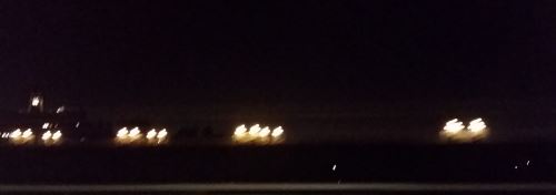
Picture by Alex Ogden

We took a few pictures the next day as well, and you can see the bridge in them, but I’m still not totally happy. On our next trip, we plan to actually drive that road and take some pictures of the bridge from the bridge. Ooh! Apparently they have a biennial festival actually on the bridge itself. So if we go back in 2020 (no way we can make it in 2018 unless my dad wins the Lottery), maybe I can get pictures of the bridge while actually walking on it. That’s a definite possibility for the future.

I’m Back from California

That was odd. I started this post and, just as I was finishing the title, I got a message saying that the backup version of this post was different from this one (which is kind of impossible, since I was just starting this post) then, as I typed the word “California,” the message disappeared and took with it everything after “I’m.”

Since public parks are one of my things, I did visit a few parks while I was out there: Griffith Park (of course), Hancock Park, Joshua Tree National Park, Leo Carrillo State Park, and Point Fermin Park, among others.

I also had the opportunity to visit a doctor in the Los Angeles area. I accidentally smacked myself in the eye with my knuckle while drying off after my shower and scratched my cornea. It was healed by the next day, but I was terrified at first that I would have to spend my entire vacation holed up in my hotel, or limited to however-many sites I could get to by public transportation in a day. I didn’t even have to stay home for one day, since I could see okay and wasn’t sensitive to light.

I got to visit the desert for the first- (and second-) ever time. The only desert in Texas is considerably west of here and I don’t think I’ve gone that far west yet. I think that the Salt Lake City area is also subhumid and I don’t think we got into the actual desert at all there, either.

I’ll start going through all this in a more orderly fashion beginning in another couple of days. Probably.

I’m Going to Start Adding Another Dimension to my Park Posts

I’ve found an organization called Falling Fruit, which is attempting to make a comprehensive map of places where foragers can find food. One of the things they are collecting is information on public (or publicly accessible) trees and other plants that are edible. San Antonio has a lot of plants that can be used for food, but its representation on the website is really kind of pitiful, with only 160-some things marked on the map. Austin is a lot smaller but has nearly twice as many locations marked.  Falling Fruit is also a licensed charity, so if you are in the United States and want to make a charitable donation, donations to Falling Fruit are tax deductible.

There are prickly pear cactus absolutely all over the place here, and not only can the fruit be eaten, but the pads themselves are edible as well. I certainly wouldn’t want to see the all of the prickly pear cactus being eaten by foragers, but it’s nice to know that it’s there, all the same. And I’m not even listing the thousands of live oak trees that litter the area, even though acorns have been used as food for millennia.

This does mean that I’m going to start revisiting some of the parks that I’ve already visited, to see what I can find there. Today we went back to Phil Hardberger Park and found more prickly pear and a mesquite tree (mesquite pods are edible). There’s supposedly Texas persimmon in the park somewhere, but I haven’t found any yet.

South Texas Destinations: Tobin (John) Park and Walker Ranch Historic Landmark Park, San Antonio, Texas

John Tobin Park

I passed John Tobin Park, which is just an activity center on a small lot on the corner of Martin and Brazos Streets, on the day of the Women’s March.  I took a couple of pictures as I walked past and told Alex that this meant that I could cross this park off my list.

I may be returning to it, more or less, after all, as it turns out. Tobin Park backs up to Alazán Creek and there is now a greenway along the stretch of the creek north of this section. Will the greenway ever reach this part of the creek? There are no plans now, but who knows what will happen with the greenway project in the future?

Walker Ranch Historic Landmark Park

I live fairly close to Walker Ranch Historic Landmark Park. And before Alex was born, that area was even closer to where we lived. As a result, for most of Alex’s life, “the park” has meant Walker Ranch.

While I’m still not entirely certain what the “landmark” is (though perhaps the entire park is the landmark, since it si on the National Register of Historic Places?), I definitely can tell you at least some of what the word “historic” is for.

As the park is near the confluence of the Salado and Panther Springs Creeks, humans have lived there for literally millennia. When the Coahuiltecans were the main human inhabitants, they camped there, and once the Spaniards arrived, they began the occupation of that space on a full-time basis.

When Spain colonized the areas which are now Florida, Texas, and Mexico, the law of Spain was that all Spaniards were required to be Roman Catholics. So, in order to count the local indigenous peoples as Spaniards, they needed to be converted. To that end, Franciscan monks moved to what is now San Antonio in the 18th century to convert the local Coahuiltecan Native Americans and they founded five missions. Mission San Antonio de Valero (which is now The Alamo) was the first one founded.

Walker Ranch Park airplane
An airplane flies near the main loop trail at Walker Ranch Park, 2014.

Hundreds of people lived at the missions, and that required food. At first, the natives and Franciscans would raise cattle near the missions, but as the local civilians began to ranch themselves, the groups would come into conflict. The various missions, as a result, founded ranches that were farther out. You can still visit one of these missions, Rancho de las Cabras in Floresville, the ranch for Mission San Francisco de la Espada. The other ranches are now in what is San Antonio proper and, as a result, most of their structures the “context” is gone.

The ranch for Mission San Antonio de Valero (which they shared with Mission de Nuestra Senora de la Purisima Concepcion de Acuna and Mission San Juan Capistran0) was the Monte Galvan. I’m trying to find the exact boundaries, but what is clear is that Walker Ranch Park is within the area that was included in the ranch.

The “Walker Ranch” name comes from the Walker family, which ranched there in the early 20th century. The Walker Ranch is on the National Register of Historic Places (it was added in 1975).

Today, Walker Ranch Park has a playground, portable restroom facilities, a picnic pavilion and several walking/biking paths.  The main path is a paved loop path that goes around a field with a windmill (I don’t know if the windmill was put there by the Walker family or not). In spring, in years when the rain is pretty good, the loop trail is a fantastic place to see wildflowers, bluebonnets in particular. There is also another, unpaved, path that follows Panther Springs Creek, and Walker Ranch Park is also on the Salado Creek Greenway. The Greenway connects Walker Ranch Park to Phil Hardberger Park to the northwest and to McAllister Park to the southeast.

Walker Ranch Park is also a great place to go deer- and planespotting. There is a community of deer that live in the park and they are habituated enough to people that you can see them, but not so used to people that you can actually get anywhere near enough to hurt them. The planes are definitely not close enough that people can hurt them, as they’re overhead. The park is in the landing pattern for the airport, and so planes come overhead pretty frequently. And sometimes, when conditions are just right, and you are far enough in the trees, you can hear the whooshing sound of the wake turbulence. For some reason, we’ve only ever heard it when surrounded by trees and not when near the parking lot. I don’t think that the wake turbulence is blocked out by the noise from the cars, because I don’t even hear it when there are no cars.

South Texas Destinations: Stone Oak Park, San Antonio, Texas

Despite it being out of the way, I’ve been to Stone Oak Park twice. The first time was July of 2015 and it was just amazingly hot. It seemed like a nice park, though, so Alex and I returned in November of 2015 so that we could finish the rest of the main walking path.

It turns out that we saw most of the exciting stuff on that first trip.

Stone Oak Park has the usual things, bicycle trails, a playground, a picnic pavilion, portable restroom facilities, and so forth. The park also has a 2.7-mile walking trail marked by public artworks. I am trying to find the names of the artworks, but haven’t had much luck so far. Perhaps this will be my excuse to return.

Stone Oak Park Artwork
Artwork at Stone Oak Park, San Antonio, Texas 2015

Stone Oak Park is also home to two caves, known as Bear Cave and Cub Cave. Bear Cave got its name from the bones of a black bear that were found inside. Cub Cave got its name because whoever named the caves wanted to stick with the “bear” theme and Cub Cave is smaller than Bear Cave. Bear Cave is blocked off to keep people from climbing or falling in. As of my last visit, Cub Cave was still open.

Stone Oak Park was founded for one very practical reason — it is in a vulnerable area of the state known as the Edwards Aquifer Recharge Zone. In particular, the caves along the recharge zone are important  for cleaning the water as it enters the aquifer.  The aquifer is where San Antonio and its surrounding area gets its drinking water. The water drains into the aquifer in a region from just outside Loop 1604, stretching up past the western boundaries of New Braunfels and San Marcos, and way off to the west to around Brackettville (which is between Uvalde and the border with Mexico).  In the process of preserving this land, the city has preserved two of the most important caves for keeping our water clean.

National Geographic July 2016, Part 1

Beyond Reasonable Doubt, by Veronique Greenwood, photographs by Max Aguilera-Hellweg

This article talks about the latest developments in forensic science. One of the techniques covered is what’s called genetic phenotyping, where they can now take a DNA sample and pull out hair, eye, and skin color and, often traits like whether the source of the sample had freckles. They can even sometimes get a general idea of the shape of the person’s face.

Of course, the hair thing might not be foolproof, as (totally aside from the existence of hair dyes), people do lose their hair sometimes and hair does eventually gray. In fact, I knew two young men in my youth who lost their hair at very young ages. It’s likely that there might be some kind of genetic component to the hair loss, but statistically speaking, in their teens or 20s the reconstructions would probably have shown them with full heads of hair.

We also talk about some of the mistakes made through older versions of forensic science, including Kirk Odom, whose hair was supposedly “microscopically indistinguishable” from a hair found at the crime scene. Turns out that the scientists never examined the hair under a microscope and that even if they had, <a href=https://archives.fbi.gov/archives/about-us/lab/forensic-science-communications/fsc/july2000/deedric1.htm>it looks to me like they can determine things like the species of the source of the hair and, if human, the race of the source of the hair, but it is not possible to narrow it down to an individual.</a>

The photograph of the photographer, by the way, was created by DNA phenotyping. There’s an interactive feature on the website where you can compare that image to actual photographs of actual photographers to see if you can figure out which was is Max.

The Battle for Virunga, by Robert Draper, photographs by Brent Stirton

Well, it’s been a while since we’ve had some unrest in Africa, so I guess we’re due. And since we’re talking about parks in the magazine this year, this article is a “twofer,” part of the Power of Parks series and about unrest in Africa.

Virunga National Park in the Democratic Republic of the Congo is the oldest national park in Africa. It is also part of some kind of turf war between at least two militias. The Battle for Virunga covers some of this recent history and discusses some of the things that the (at the moment) current director, Emmanuel de Merode, is doing to improve the park. One of these things is that they are building hydroelectric power plants in the park, hoping that the electricity being produced will (a) cover the park’s expenses into the future and (b) give potential entrepreneurs the chance to begin to develop businesses in the region that will give the children of the area something to aspire to besides joining a militia.

South Texas Destinations: O.P. Schnabel Park, San Antonio, Texas

The last time I looked at the official list of parks, I thought that O.P. Schnabel Park was listed under “O” and that I’d skipped it, but apparently it’s under “S” and so it’s up next.

Schnabel Park was founded in 1964 with the name “Bandera Road Park,” which is certainly descriptive, but not very exciting. In 1977, they renamed the park in honor of O.P. Schnabel, founder of the Beautify San Antonio Association. Do you know how hard I had to dig to find even that little bit on Schnabel? Honestly. I searched Google for his name and the first three pages or so were all articles on the park. I tried putting a “-park” in there and, apparently due to a bug, still listed the park. So frustrating. I even tried Find a Grave to no avail. Apparently, wherever his grave is hasn’t been indexed yet. Finally, I got the “-park” to work and you know what I found? Lots of listings on the OP Schnabel apartments. Picture me resting my elbows on my keyboard tray and putting my face in my hands here. So, then I tried again with “-park -apartment” and finally got, like two things on the man, both of which were writeups for the Beautify San Antonio Association archives. I’ll take what I can get at this point.

Schnabel Park Deer
Deer at OP Schnabel Park, San Antonio, Texas

As you might expect from the prevalence of the park in the Google results, Schnabel Park is one of the best parks in the city. The park has two picnic pavilions, a kitchen, sports fields (baseball, basketball, soccer), at least two playgrounds, restrooms, a swimming pool and at least 4.5 miles of hiking trails. Schnabel Park also has a trail head for the Leon Creek Greenway and is home to the Braundera YMCA. I also know some people who go rock-climbing there as well, though I’m not sure if that’s an officially sanctioned activity.

Alex and I have seen a decent amount of wildlife in the park on our visits, including a buck who walked across the path right in front of us (see image).  We have also seen several military aircraft fly overhead including, on one memorable occasion, a C-5 Galaxy. We also have attempted to access the Leon Creek Greenway from the park a few times, and the trailhead is quite a ways from the actual greenway, so we usually give up before getting to the greenway.

Our 2016 Chicago Trip: The Final Day

Looks like we’ll be returning to 1988 on or around December 2, because this brings me to the end of our 2016 travels.

Having discovered previously that the hotel breakfast was somewhat less exciting than one could hope, Alex and I skipped it and instead checked out of our hotel, leaving our suitcases behind the front desk. Then we started off for Lincoln Park. Now, as I have told you before, my folks and I didn’t spend much time in Lincoln Park in the past, and I had hoped to spend some time exploring the park. We had two things counting against us however. 1. We had plans to meet with Alex’s uncle (my former brother-in-law) for lunch so we had to get to the park, do whatever exploring we needed to do, and get back to the uncle’s work by 1:00 and 2. It was really bleeding hot out there that day. You’d think that nearly a quarter of a century in South Texas would make me immune to the heat, but if anything, I think it’s made me more sensitive.

Alex and I had been eyeing the Water Taxi service for our entire trip, and this was our chance. We caught the Water Taxi at 2 North Riverside Plaza and took it all the way to the Michigan Avenue Bridge. I got pictures of some of the more famous buildings of Chicago — Marina Towers, the Merchandise Mart, 333 Wacker Drive and so on from the river level. Once we were on street level, we took a bus to Lincoln Park. I had kind of hoped to stop at the Water Tower on our way up, but apparently if you are using cash you can’t get the transfer on the bus.

Once we got to Lincoln Park, we headed directly for the zoo. I put a few dollars in the “support the zoo” donation jar and we got to exploring. Fortunately I had been to Lincoln Park Zoo in the previous 15 years or so, so I at least knew about the Park Place Cafe food court. Because that was one of our first stops. We got some veggies and pop (and I think we bought a pastry of some sort?) and fortified ourselves for the walk.

We explored pretty much all of the zoo, but it was getting late and I had one more stop that I wanted to make before heading to lunch.  Back in 2014, when Alex and I went to Italy, we went to the beach in Santa Severa and I took a picture of my feet in the Mediterranean. I followed that up with my feet in the Great Salt Lake, and so, of course, I needed to get a picture of my feet in Lake Michigan (even though I’ve swum in Lake Michigan a bunch of times, I felt that I needed that picture for a sense of completion). So Alex and I hiked out to the lake and I got my picture. Then we walked back to the bus stop and took the bus to a couple of blocks north of his uncle’s work.

Lincoln Park Lake Chicago
The lake outside Cafe Brauer, Lincoln Park Zoo, Chicago, looking south towards downtown, 2016

We had a very nice (if a bit brief) lunch with his uncle, and then Alex and I headed back north on Michigan Avenue. I really, really wanted Alex to see the Water Tower, as it is such an important landmark for the city. As we walked, I pointed out some of the more interesting buildings (including Chicago Place, which was a mall for about 20 years but is currently being converted into office space).

After we visited the Water Tower, we walked back down Michigan Avenue until just after we crossed the Michigan Avenue Bridge and hiked back along the new-ish Riverwalk of the river. When I was growing up, all there was along the river were steep cliffs of concrete. I really enjoyed the landscaping and construction along the Riverwalk and hope that this ends up being a real boon to the city.

Then we walked back to our hotel, picked up our suitcases, and headed off to the subway station to begin our trip back to Texas.

South Texas Destinations: Phil Hardberger Park, San Antonio Texas

Phil Hardberger Park is one of the crown jewels, if not the crown jewel, of the San Antonio Parks and Recreation system. The city purchased the family farm of the Voelcker family and have turned the site into a natural and historic landmark. Hardberger Park is 311 acres and has 19th century buildings on the site.

Hardberger Park is unusual in that it is actually two separate parks, to all appearances. The eastern part of the park has an entrance on Blanco Road and seems (to me at least) to be the more heavily visited of the parks. The eastern side has, in addition to the usual walking paths and playground, the picnic pavilion and the larger of the two dog parks. The western half of the park has an entrance on Northwest Military Highway and has, in addition to the usual walking paths and playground, the Phil Hardberger Urban Ecology Center.

The west side also has an art installation, “Golden Age” by Anne Wallace, which uses reflective metal to simulate the appearance of a wildfire on the prairie area behind the Urban Ecology Center. Personally, I think that Wallace miscalculated the height of the grasses in the prairie, her explanation of the work reads, in part, “As Hardberger Park’s restored grassland matures, the gold will appear to hover just above the prairie, using the sun and wind to bounce light off the tops of the grasses,” except that by now, the gold is buried within the grasses for most of the year. I wonder if it’s too late to raise the poles holding the circles up another three to six inches . . .

Geology Trail, Hardberger Park, San Antonio
The Geology Trail, Phil Hardberger Park, San Antonio, Texas

Alex and I have explored the eastern side of the park pretty thoroughly. If you are in San Antonio and are starved for some greenery, there is a lovely corner of the Geology Trail that is really vibrant in the springtime. We have spent more time but done less exploring on the western part of the park, because there are a lot more paths over there. Somehow, since Hardberger is one of the closest parks to my home, we only go there when we’re out of ideas on where to go, and since between the heat and the fact that there just aren’t many people out there, we tend to do just a short walk and then hop across the street to pick up groceries (as I write this, the western entrance is across the street from the Alon Market HEB supermarket; I make no promises that the supermarket will be there whenever you’re reading this).

I mentioned earlier that there are two halves of the park with separate entrances on different streets. The halves of the park are separated by Wurzbach Parkway, a four-lane highway with a 50 mile per hour speed limit. So it’s cross-able, but it can be something of an adventure getting from one side to the other. The plan is to add a bridge joining the two halves. And the bridges that are on the Howard W. Peak Greenway System are very nice, and would serve for the purpose of getting visitors safely across. That’s not the plan, however. The plan is for a $25 million bridge that would be 150 feet wide and have enough native greenery on it that animals wanting to cross from one side to the other will be encouraged to use it rather than risk crossing the road as well. At the moment, it looks like voters will be voting on a bond to raise $15 million of this money in May 2017. Will the bond pass? After the November 2016 elections, who knows? Will the Hardberger Park Conservancy be able to come up with their share of $10 million? I don’t know that either. If I ever do find out, I’ll let you know.

Update: 3:10 p.m. Actually you can no longer cross Wurzbach Parkway. They’ve put up a Jersey barrier. Unfortunately, this is not a barrier made of jersey material (which would be easy to move aside and get through) but is, in fact, a 3.5-foot-high cement wall. As a result, the only way from one side to the other is to drive until when (if?) they build that bridge.

2016 Chicago Trip: Our Second Day

We got up early and hit the complimentary breakfast, which was lackluster. The “scrambled eggs” tasted like those cholesterol-free artificial eggs, judging by the overwhelming onion flavor that they had. I’m not a big fan of onions, so that was disappointing.

Then we hit the road. Our first stop was the Harold Washington Library, which I, personally, love. Yeah, I can see the disenchantment with the big verdigris structures on top, but I love the rest of the red granite exterior and the inside is lovely. I also have a sentimental connection to the building. They were putting the finishing touches on it during my time working in the Loop and I walked past the construction site nearly daily. My folks and I also went on one of the official tours when the library officially opened, but I don’t recall ever visiting the winter garden on the top floor. So, Alex and I took the escalators all the way up and then all the way back down again. I have to admit that I slipped my shoes off in the winter garden because they were just the tiniest bit squeaky and the silence up there made the squeakiness really loud.

After we left the Harold Washington Library, we continued eastward on Van Buren and into Grant Park. We passed the statue of Lincoln and then headed for Buckingham Fountain. From there, we went on to the Field Museum of Natural History.

While in the Field Museum, we visited all of my favorite exhibits: Ancient Egypt, the gemstone and jade halls, the taxidermied Lions of Tsavo, and, of course, the dinosaurs. They have modified that section of the museum since the last time I was there, focusing on the eras in which the different animals on display went extinct. They also have the old Charles R. Knight paintings in the same rooms with their respective eras. I love those old paintings, even though they’re a bit out of date by today’s scientific standards. Isn’t it interesting that two of the artists whose work I’ve loved since I was a child — Monet and Knight — both had visual impairments? I have always been extremely nearsighted, so perhaps something about their work feels sort of “homey” or something. We also found that the meteorites, which had been removed from display for decades, if I recall correctly, were back on display. It was lovely seeing them again.

We headed from there to the Adler Planetarium (writeup to follow someday). I hadn’t been to the planetarium in years. Since the last time I was there, they added a whole glassed-in section, and, I think, at least one sublevel. So Alex and I spent quite a bit of time there. We were constrained by time and finances, so we had to pick just one show to see, which ended up being in just a regular auditorium, rather than being in the big dome. I have promised Alex that we’ll do another planetarium sometime soon so that we can get the dome show in.

After that we went to the Shedd Aquarium (which I also have yet to write up). We got the most basic admission, which only lets you in to see the fish and other animals on the main level. But that ended up being enough. I also love the building itself. The attention to detail in the doorways and things makes just walking around the building an enjoyable experience.

I had planned to take Alex to Aurelio’s Pizza* in Homewood. While we were looking up train schedules, I stumbled across the information that there is (or perhaps was, for those of you reading this in the future) an Aurelio’s in the South Loop, almost on the doorstep of the Museum Campus. As it was around 5:00 by then, we sat down for a while before heading off for pizza. I got some pictures of the museums without crowds around them while we enjoyed the early evening.

I had hoped to make it to the park on Northerly Island (which used to be the Meigs Field airport), but, again, it was 5:00 by this time and we were exhausted.

We had our pizza and then headed back towards our hotel. On the way up Michigan Avenue, I happened to notice the Rosenberg Fountain, which may be the oldest piece of public art in Grant Park (I’m not sure if the fountain or the Art Institute lions are older). So I made Alex stop so that I could take pictures. One thing led to another and we ended up walking back north through the park while I took pictures of the art.

Then we hiked back to our hotel and got some rest for what would turn out to be a record-setting day of walking on our third day in Chicago.

*I hardly ever mention the names of businesses in these writeups, but I figured that this would be far more complicated if I tried to talk around the name of the restaurant rather than just naming it outright.