South Texas Travel History, HemisFair 1968, San Antonio, Texas

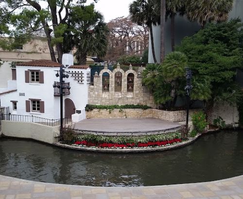
This post is to give you some background on my next couple of downtown San Antonio destinations.  All of these, the Institute of Texan Cultures, the Tower of the Americas, and HemisFair Park, are left over from the 1968 World’s Fair, which had the title “HemisFair ’68.”  Under a principle known as “eminent domain,” the city seized the houses in and razed a residential neighborhood on the southwest side of downtown for the fair, which was a shame.  Over a hundred buildings in the neighborhood were named as historic by the San Antonio Conservation Society, but ultimately only around 20 were saved.  Those 20 houses are in the park today.

The theme of HemisFair ’68 was “The Confluence of Civilizations in the Americas,” and San Antonio chose to host the fair that year to honor the 250th anniversary of the founding of San Antonio. If a centennial is 100 years, a sesquicentennial is 150 years, a bicentennial is 200 years, is there a term for 250 years?  Let’s check Google.  Apparently 1968 was chosen in honor of the sestercentennial of the founding of San Antonio.  Or possibly the quarter-millenial, since 250 is one-fourth of 1,000.

Looking at the buildings that still stand today, it seems that HemisFair ’68 must have had an odd layout.  If you walk around HemisFair Park today, you’ll see that some of the buildings seem (to my mind) to point off in odd directions.  The park tends mostly west-to-east, or northwest to southeast, (starting at Alamo Street) but two of the pavilions, the Women’s Pavilion and the Eastman Kodak Pavilion, are off near the southern edge, with what sure looks to me like the entrances pointing southeast, away from the center of the fair.  The Universidad Nacional Autónoma de México  (“UNAM”) is tucked up in a strange place alongside the Henry B. González Convention Center with a door that faces, again, away from the center of the fairgrounds. The building that UNAM is in might not be original to the fairgrounds, though.  There’s something labeled “Amusement Area” in that spot on the map But it still seems kind of out of the way in its current location.  I wish I could find some kind of diagram of the flow of traffic or something that would indicate why these locations seemed to make some kind of sense.

Speaking of things that didn’t make much sense, there’s Beethoven Hall.  Today Beethoven Hall is home to the Magik Theatre, but originally it was the concert hall for the Beethoven Männerchor (Men’s Chorus). The planners for the fair decided that Alamo Street needed to be widened for the fair, and for some reason they decided that the best way to do this was to lop the front off of the building, then they just bricked up the hole in a way that looks very 1960s.   They could have widened the other side of the street, but the resulting street would have been curved, which the planners apparently felt would not give a good impression of the city to visitors (and north of Beethoven Hall the street curves anyhow, so I don’t know why they objected to having a curved street south of the hall).

Some of the hotels that were built for the fair are still there today. Of particular note is the Hilton Palacio del Rio hotel, which, for years, held a record for construction of 202 days. The rooms were built off-site and then lifted into place with a crane.  One of the hotels which is no longer there was the first La Quinta Inn.  If I recall, the original La Quinta is now underneath River Center Mall.

Ultimately, the fair did make a good impression on visitors, which cemented San Antonio’s reputation as a tourist destination.

I Think I’ve Talked About the Howard W. Peak Greenway Trails System Before . . .

But I think that the Howard W. Peak Greenway system may end up needing its own tag.

This is because I hope to eventually walk the entire thing.  Not at once, though that would be cool to take a few days to do.  And it would take a few days, because at the moment, the brochure (Warning! This link leads to a PDF!) says that there are currently 47 miles of trails.  My current record (since I’ve been using the pedometer on my phone) is 12 miles in one day.  So if I were able to keep that pace, it would take me, well, about four days to walk the whole thing.

Eventually, the greenway system will ring pretty much the entire city from the Medina River in the south to Leon Creek in the west, and then the Leon Creek Greenway will meet the Salado Creek Greenway up at Eisenhower Park (just south of Camp Bullis) and then the Salado Creek Greenway will go down the east side of the city.  The Riverwalk runs down the center, but it will eventually connect to the Medina River. There don’t seem to be any plans to make the Leon Creek Greenway meet the Medina River Greenway, nor the Salado Creek Greenway with the Riverwalk.  It would be fantastic if they did, though, because then one could just start anywhere in the system and reach any other part almost without ever going up to street level.

And I hope to walk all of it eventually.

So far, I’ve done the middle part of the Salado Creek Greenway, the far northern part of the Leon Creek Greenway, and, just at a rough guess, the northern 70% or so of the Riverwalk.  So I have my work (or my walking, technically) cut out for me.

South Texas Destinations: Milam Park, San Antonio, Texas

Okay, do I start with Benjamin Milam or with the cemetery?  :flips coin:

I literally did just flip a coin there, and it came up tails, so the cemetery it is.

In the 1850s, there were two graveyards in the area near the intersection of Houston and Santa Rosa Streets.  On one side of the line which is now Houston Street (underneath where the Children’s Hospital of San Antonio is today) was the Catholic cemetery.  On the other side of that line was a public cemetery for non-Catholic burials.

After only a few years, the number of dead in the public cemetery became too great for the small plot of land and all of the bodies there, except, to our knowledge, one, were moved to other cemeteries.  That one body belonged to Ben Milam.

Benjamin Rush (Ben) Milam was born in 1788.  In the early 1800s he moved to Texas and when the war for Texas Independence began, he is claimed to have called for recruits to take the town of San Antonio by calling out “Who will go with old Ben Milam into San Antonio?”  In one version of the tale, he is said to have drawn a line in the dirt on the ground with a stick in his hand.  This will be important later.

Milam was killed during the Siege of San Antonio by a gunshot to the head.  He was on his way to the “Veremendi Palace, which the house gained the title “Palace” because it had been home to one of the governors of Coahuila y Tejas.  The Veremendi Palace was on Soledad Street not too far from Main Plaza.  Milam’s body was buried in the yard of the house originally and later his body was exhumed and moved to the public cemetery.

Once his body was interred in the public cemetery, a marble marker was placed over the spot.  Later that marker was removed and replaced by a granite monument, which was originally supposed to have been surmounted by a statue.  They never put the statue on the monument.  34 years after Milam’s burial, they turned the land into a park and named the park for Milam. In 1938, the Texas Centennial Commission put a statue of Ben Milam holding a rifle aloft in his right hand on the west edge of the park.  Over the intervening decades, the knowledge that the granite monument was a gravestone was lost and, in 1976, the marker was moved as part of a park beautification project.

Milam Statue, Milam Park, San Antonio
The statue of Ben Milam in Milam Park, San Antonio, Texas

In 1993, the city began renovations on the park and the workers found a skeleton under a concrete slab.  The slab was near the center of the park and was just little larger than the size of the granite monument.  Since the granite monument was heavy and had originally been planned to be even heavier, the archaeologists who were monitoring the project decided that the concrete slab may have been the original foundation for the granite monument.  If that were true, the skeleton had a good chance of being Milam’s remains.  They exhumed the body and took it to the Center for Archaeological Research at the University of Texas at San Antonio.

The remains were of a man of about Milam’s height who was about Milam’s age at death.  Only fragments of skull were found, but they had markings consistent with having been killed by a gunshot to the head.  Remember the stick in Milam’s hand up there?  In that tale, he didn’t pick it up from anywhere, it just sort of was in his hand.  The body was found to have belonged to someone with arthritis in his legs and back, and, well, a cane is, in fact, a stick that you hold in your hand.

Remember that that land was only a cemetery for a few years.  The odds of another body having been placed beneath a concrete slab the size of the grave marker for Milam during those few years are slim.  Add to that the fact that the body found was a male the same height as Milam makes the chance that it’s anyone else slimmer.  That plot of land was a cemetery decades before the era of the old west gunfight (and San Antonio hasn’t been so much “western United States” as “northern Mexico”).  Most of the bodies in the cemetery had died of things like cholera and old age.  As a result, the bullet wound to the head makes it nearly certain that the skeleton belongs to Milam.

The body was re-interred under the statue in Milam Park in 1994.

Milam Park is a nice little (emphasis on “little”) park. From what I can tell, it is around four acres in area and, in addition to Milam’s grave, has a playground, a gazebo, picnic tables, and a quarter of a mile of walking trails.  As with most other urban parks, Milam Park looks pretty wheelchair accessible.  The park is all level and paved and there are curb cuts.

Reference:

Exhumation of a Hero, Colonel Ben Milam: Milam Park Renovation, Phase I, Cynthia L. Tennis, Center for Archeological Research, University of Texas at San Antonio, 1995

South Texas Destinations: La Villita Historic Arts Village, San Antonio, Texas

The area where La Villita Historic Arts Village (“La Villita”) stands today has been occupied by humans for centuries.  Prior to the arrival of the Spaniards, that are on the shore of the San Antonio River had been home to a community of Coahuiltecan Native Americans.  Around 1722, the soldiers from the Presidio (the Presidio was where Military Plaza and the San Antonio City Hall are today) lived in huts on that site with their families.  That community was later destroyed by a flood.

Then, in the early 19th Century, a group of immigrants from Germany built more permanent structures on the site.  The Germans were followed by immigrants from Switzerland, France, and Italy.  These are the buildings that are there today.  As with so much of the historical sites of San Antonio, the buildings of La Villita fell into disrepair.  During the Great Depression, the buildings were restored to their original condition, and La Villita began its current life as an arts center.

Today, La Villita is home to shops, galleries, and restaurants.  Several festivals are held there, including the Fiesta event, A Night in Old San Antonio (popularly called by the acronym “NIOSA”). My family and I also attended the India Association of San Antonio’s annual Festival of India at La Villita in the early 2000s.  Even though this information will be outdated in a couple of months, the 2016 festival will be held on March 26.  I do not know if it will be held in La Villita again, though.

The Arneson River Theatre abuts La Villita on the San Antonio River side.  The theater is set up in an unusual but picturesque way, with the audience seating on the La Villita side and the stage on the other side of the river.

Arneson River Theatre, San Antonio
The stage of the Arneson River Theatre, San Antonio, Texas

The streets of La Villita are level, but not all of the shops are wheelchair accessible. The Arneson River Theatre has steps leading down to (or up from, depending on your perspective) the river, but I am pretty sure that there is wheelchair accessible seating at street level.

Merry Christmas from San Antonio, Texas

Locks and Dam, San Antonio
The Locks and Dam at Brooklyn Avenue on the San Antonio River, December 2015

Alex and I went downtown this weekend looking for the perfect San Antonio Christmas picture.  We took pictures of the Bexar County Courthouse and of the front of San Fernando Cathedral (the cathedral was undecorated, but Main Plaza was pretty empty, so I figured this was as good a time as any to get a really good picture, which I need to resize and crop and put on my post on the cathedral).  I also took pictures of the Christmas tree in Main Plaza and then we hiked to Alamo Plaza and I took a picture of the Alamo with a wreath over the door and of the city Christmas tree (which was decorated with ornaments shaped like basketballs and Spurs logos, which is definitely unusual, but not what I was looking for).

When I wrote my post on the Museum Reach section of the River Walk, I realized that I wasn’t sure if I’d walked the whole thing from downtown.  So while we were downtown, we walked the River Walk from the Paseo del Alamo (which leads from the space between the buildings across from the Alamo, down through the entrance of the Hyatt Regency hotel and then out into the River Walk proper.  We made a right and walked kind of east and north from there to the locks and dam (and I know that I’ve covered everything from the locks and dam to the Witte Museum, so I am no officially done with the Museum Reach section of the River Walk).  And there I saw the perfect picture — they had hung a wreath on the front of the dam.

I then spent the next few days massaging the picture in an effort to make the wreath stand out more.  I ended up just cropping the original a bit and then writing a few paragraphs to explain how I came to take this photo and to point out the wreath, just in case you miss it.

South Texas Destinations: San Pedro Springs Park, San Antonio, Texas

San Pedro Springs Park which has also been known as just “San Pedro Park” in the past, is (depending on how you count) the second-oldest public park in the United States.  The land where San Pedro Springs Park currently is was set aside for public use by the King of Spain in 1729, making it 95 years younger than the oldest public park in the United States, Boston Common.  The “depending on how you count” is because the Trust for Public Land, which apparently uses different criteria for “park” places San Pedro Springs Park at tenth-oldest.  Either way, though, San Pedro Springs Park is one of the oldest parks in the country.

Humans have been living in and around the area that is now San Pedro Springs Park for millennia.  When the Spaniards arrived in 1709, the area was home to a Coahuiltecan tribe known as the Payaya.  The Spaniards knew a good thing when they saw it, so they decided to move in there, as well.  Unfortunately, there were two groups of Spaniards — soldiers and Franciscan missionaries and there was apparently some kind of conflict between them.  Eventually, the missionaries set up on one side of the river and the soldiers on the other.  This is the first of the missions named for San Antonio de Padua (the final one of these is the Alamo).  The mission was moved to the other side of the river, then to where St. Joseph’s Church is today (I must remember the link when I get to writing up St. Joseph’s), and then to its final location.

In what is likely to be the most confusing sentence I will ever write, parks today aren’t what they were then.  Parks started out as land for sort of general public use.  Boston Common, the oldest park in the United States, was originally a field where residents could graze their cattle.  And so it was with San Pedro Springs Park.  The original use was primarily for travelers, however.  The travelers would let their animals eat and drink and refill their water containers in this area.  It wouldn’t become a park as we recognize the term until 1864.

Prior to 1864, one tenant of the land that is now San Pedro Springs Park was the military.  Because of this history, the stone house in the park is generally thought of as an old fort or possibly a storage building for weapons.  No one is sure where the building, generally known as the “Block House” was built, but a 1909 photograph shows a building that was already apparently old, and the architectural style looks to be from the mid-1800s.

Among the uses that we are sure the military put the land to was the garrisoning of soldiers and stabling camels that the Army attempted to use in military campaigns.  The park was also a prisoner-of-war camp during the Civil War.

In 1864, a man named Jacob Duerler took over the park.  He got a license to use the park for 20 years in exchange for fixing the damage done by the soldiers (and the camels) during the years when the military used the park.  Duerler opened up a number of amusements including a fish pond and a bar.  Duerler died 10 years into the 20-year period, and eventually his son-in-law took over. His son-in-law mismanaged the property and so when he wanted to break the lease early, the city allowed it.  A new tenant, Frederick Kerbel, took over and made still more improvements to the park, including landscaping and the addition of a “grotto,” generally thought to be a summer home, which stands there today, and which looks kind of like a very large statue of Cousin Itt from The Addams Family.

When Kerbel’s lease expired, the city took over management of the park.  Some of the buildings built during the era when the park was let to tenants remained, including the grotto and a strange star-shaped structure that originally had a fountain in the center.

When I first moved to San Antonio, the park had not been renovated for a long time and it looked sort of post-apocalyptic.  They have done quite a lot of renovation, including upgrades to the swimming pool and the addition of a small skateboarding park.  The park has a lot more visitors these days than I saw in my first visits, which is lovely to see.

Since San Pedro Springs Park is a historic landmark, there are some places that are not handicap accessible.  For example, the photo at the top of the page was taken at the top of a flight of stairs.  The top of that sort of bluff thing is accessible by a sloped path, however.  The “shallow end” of the pool actually is a ramp that leads into the pool, making the pool itself handicap accessible (though I’m not sure about taking one’s wheelchair into the pool itself), from what I have read.

South Texas Destinations: San Fernando Cathedral, San Antonio, Texas

I have always loved visiting churches.  We didn’t visit churches much on vacations when I was growing up, probably because my dad is an atheist.  I do remember visiting what looks like Bruton Parish Church in Colonial Williamsburg in 1979 and The Cathedral of St. John the Divine in 1988.

And while it’s not Notre Dame de Paris, or even York Minster (as I was reminded several times by another transplant), I do love San Fernando Cathedral. I’m sort of an amateur tour guide and San Fernando Cathedral is on nearly every tour I give of the city.

The cathedral was originally the parish church for the colonists from the Canary Islands, who arrived in 1719.  The first stones of what was then called Nuestra Senora de Candelaria y Guadalupe (and which is now San Fernando Cathedral) were laid in the early 1700s.  I have seen numbers ranging from 1729 through 1738.  And, by the way, both aspects of Mary the Mother of Jesus, as Our Lady of Candelaria and as The Virgin of Guadalupe, still have their places in the cathedral.

Beginning in 1868, the building, which had fallen into disrepair, was fixed.  In addition, the church was enlarged and the Gothic front was added. One tower was finished decades before the other, and in 1874, the church was designated a cathedral. You can still see the original church if you go around to the Military Plaza side of the building.

San Fernando Cathedral San Antonio Texas
San Fernando Cathedral, San Antonio, Texas

In 2003, the cathedral underwent a major renovation to stabilize the foundation.  Additionally, according to news sources at the time, the Second Vatican Council recommended placing the altar closer to the congregation.  In aid of this, the altar was moved from the front of the church to the center of the church and the seats were placed in a sort of cross shape around the altar.

If you enter the cathedral through the left-hand (viewing from the front) door, you will see a marble casket that says that it contains the remains of Davy Crockett, William Travis, and Jim Bowie.  This is one of the most interesting parts of the cathedral for me.

In the last years of his life, Juan Seguin wrote a letter saying that he buried the remains of Crockett, Travis, and Bowie under the altar of the cathedral (which had been a parish church at the time).  In 1936, when they were replacing the altar, they did, in fact, find human remains.  This caused someone to remember the letter, and so the decision was made that these were, in fact, the remains of Crockett, Travis, and Bowie.  The remains were put on display for a year and then placed in the marble casket.

While this is a romantic story, however, there is some reason for doubt. For example, it is an established fact that the dead from both sides of the battle were burned on three pyres near the Alamo, and no mention is made of any special considerations being taken for the bodies of those three men.  So far as I know, the only fighter on the Texian side whose body was given special consideration was Gregorio Esparza.  Esparza’s brother fought on the Mexican side and he got special permission to claim his brother’s body and give it a burial. Additionally, Seguin was not in San Antonio when the bodies were burned, so he could not have separated their remains out from the rest at that point.  Additionally, the marker says that “other Alamo heroes” are in the marble casket, so perhaps Seguin didn’t separate the bodies out, but took some ashes from the pyre that the three were supposed to have been burned on.

Additionally, the story in the Express said that the bodies were found in three separate graves, and I have found that apparently bodies have been buried in San Fernando Cathedral in the past.  Two of these bodies were Simon de Herrera and Manuel Maria de Salcedo.  Both had been governors of Texas while Mexico was still part of Spain.  During the War for Mexican Independence, one of the battles, The Battle of Rosillo Creek, was fought in 1813 at a location around 11 miles southeast of the cathedral.  Following the battle, Herrera and Salcedo, among others, were executed and a priest, Jose Dario Zambrano, took at least Herrera’s and Salecedo’s bodies and buried them in the church.  Is it likely that some of the the bodies that were exhumed in 1936 were those of Herrera and Salcedo?  Maybe not.  Is it possible?  Definitely.

San Fernando Cathedral is downtown on Main Plaza.  The cathedral is handicap accessible.

South Texas Destinations: Lockhart State Park, Lockhart, Texas

I really put the mileage on my state park pass this year.  Alex and I may actually have gotten our money’s worth this year.  One of our outings was when we took a friend to Lockhart State Park.

I wanted to check out Lockhart State Park because of it was built by the Civilian Conservation Corps (“CCC”). The CCC was a way for unemployed men between the ages of 17 and 28 to help the nation out and make some money during the Great Depression.  The CCC was founded in 1933 with the goal of not just keeping young employed people busy and help them become more employable, but also to raise awareness of the outdoors. And it worked, on all counts.  There was a maximum of 300,000 young men at a time in the CCC, and in the nine years that the CCC existed, over three million young men worked with them, so each young man was with them for just a little more than ten months. Each young man could enroll for up to four six-month periods if they were unable to find work at the end of each six-month period. In order to end up with an average of 10.8 months per participant, a lot of participants must have found jobs after their first six-month period, and very few had trouble finding work for the entire two years.  And the rest of the population of the United States gained a lot from the CCC as well.  Over 800 parks, 29 of which were in Texas, were built by the CCC.

So, having read about the CCC involvement in Lockhart State Park, and having seen a list of the structures they built, I had to go check it out.  Unfortunately, I decided to check it out in August, so we didn’t get to explore as much as we would have liked.

Alex and I invited a friend to come with us, and we got as early a start as we could, which was around 10 a.m. Lockhart State Park is just south of Austin, so it’s about an hour drive from San Antonio.  We had some trouble getting to the park, as there was construction on Texas 130, and Google Maps apparently didn’t know about it.  We had hoped that the construction would start after our turn for the park, but the road was blocked off just at the turn, so we had to double back.

Lockhart State Park has several amenities, including a swimming pool and a nine-hole golf course.  If you aren’t interested in golf or swimming, it is still a nice park to visit with around three miles of (unfortunately, not handicap accessible) trails and, from what I can tell, around 20 structures built by the CCC, including a recreation hall and water tower, a residence, a bridge, several check dams, and the golf course.  The swimming pool is actually the second swimming pool built at the park.  The CCC built a swimming pool which has been filled in.  You can still see the outline of the pool on the ground, however.

Lockhart State Park pool outline
The outline of the pool at Lockhart State Park

On the whole, we really enjoyed our very brief visit to Lockhart State Park and hope to return now that it’s cooler and explore more. However, unless you are really into state parks, or golf, it might not be worth a special trip.  As a side trip from a trip to Austin, however, Lockhart State Park might just be perfect.

Parks in (and near) San Antonio

So, today one of my co-workers said, “There aren’t any good parks in this part of the city.” Well, one of the things that Alex and I do on our weekends is explore city and county parks (and parks beyond the city and county), so I took that as a challenge.

At first, one of the pharmacists suggested Friedrich Wilderness Park (one of my personal favorites), which is up a ways on Interstate 10.  I then asked what my coworker considered to be “this part of the city,” and she said, “north of downtown.”

I then listed Government Canyon State Park and Hardberger Park and Walker Ranch Park and Denman Estate Park.  The other pharmacist said, “There’s one on Bandera, isn’t there?” This is Schnabel Park.

Finally, before I got too out of control, I said, “I can do this all day, but just one more.  Eisenhower Park, which is straight up Northwest Military until you run out of street.”

I didn’t even get to mention Guadalupe River State Park, or Crownridge Canyon Park or the Cibolo Nature Center (which is in Boerne and the last time we were out there, there was talk about making the other side of City Park Road a park, and they might just have done this by the look of things) or Stone Oak Park (which was not as wooded as Google Maps made it look, so Alex and I promised to come back once the weather was cooler) or any of the probably a dozen other parks I’ve visited in the last couple of years. I even found another new park while I was writing this post — Panther Springs Park.

I really can do this all day, but it’s my bedtime now so I’m going to stop here.  However, since you are not a captive audience and can leave whenever you want, I will be writing up all of these parks (and probably some more that I can’t remember right now) as individual South Texas Destinations posts in the future.

Before I go to bed, however, one more thing. I had two problems with essay questions when I was in school.  One of these was that I have some sort of motor coordination disorder.  I’m not actually handicapped so you’d notice, but I have always had poor both fine and gross motor skills (this may be part of why walking is my major form of exercise — I know I can do it successfully). As a result of this motor coordination problem, writing by hand is very tiring for me.  I’d get tired long before I ran out of ideas on essay questions (I also never knew that other students didn’t have this kind of hand fatigue from writing — I always sort of assumed that the pain and fatigue was part of the test).  The other is that it never occurred to me that the point of essay questions was to just dump whatever you can remember onto the page.  It seemed that they should be written well.  Otherwise it wouldn’t be an essay so much as a bullet-point list.  As a result, if I couldn’t make an idea fit into the flow of what I was writing, I would just leave that idea out, which led me to often only listing part of what I knew.

All of this is in aid of me sticking in an idea that I can’t make flow with the rest of this post. Back about eight years ago or so, San Antonio came out really high on one of those “fattest cities” lists.  One of the websites reporting on it, possibly the originating site, blamed at least part of it on having a very low number of parks per capita. While I was writing this, I found one article, from 2009 (San Antonio was #3 on this list), but I don’t think it’s the one I was thinking of (I swear I remember my ex talking to me about it and we split up before 2009). The number of parks in the 2009 article was 214.  It seems like every street corner has a park these days.  I wonder if some of the parks that I’ve been visiting, and that I will write about, were created after 2009. The Howard W. Peak Greenway System, which are paths that follow the creeks, was approved by voters for the first time in 2000, but I don’t know when the first trails opened.  I think that I may make a note on my posts on city parks what year they were founded, just to see if my perception that many of these parks date from after that checks out.

As to whether these kinds of rankings actually mean anything,  I found this article at PubMed, which I am linking to so that I can save the link to read in the future. Maybe I’ll read it tomorrow, while I’m on my lunch.

South Texas Destinations: The Alamo, San Antonio

Nearly everyone in the United States has some awareness of the Alamo, even if it’s just our fifth-grade teacher saying “something something ‘Remember the Alamo’ something something” in social studies.  Or, “Hey! Isn’t that the movie with John Wayne?” There’s a lot of that going around.

The Alamo, more properly called “Mission de San Antonio de Valero,” was one of the five missions in San Antonio that were founded by Franciscan missionaries from Spain.  The word “Alamo” means “cottonwood,” and no one is sure how the mission got this nickname.

The original Alamo mission was in or near what is now San Pedro Springs Park (writeup to follow later, but for now, the header image on this blog is from the park). The mission moved several times over the years before finally settling in its current location near the San Antonio River.

What we see as the Alamo today is by no means the entire mission.  The mission started not too far behind the current buildings (which were the church and the convento, where the monks lived) and stretched out in front of the mission, across Alamo Street. As I write this, you can see the foundation of the original walls on the other side of Alamo Street. There are discussions of somehow rebuilding the complex, but with buildings that are also historic landmarks on the other side of the street, I find that impracticable.

You may find it odd that the Alamo grounds didn’t to all the way to the river.  That is because the missionaries set up an alternative sort of water delivery system called “acequias.” The acequia system in San Antonio consisted of seven acequias, one for each mission, one for San Fernando de Bexar, the original village that eventually became San Antonio, and another that started out as a flood control measure in the late 19th century.

Alamo acequia with koi
The acequia behind the Alamo, which was, at least in 2014 when I took this picture, home to a school of koi.

As an aside, if you know your Catholic saints, I am sure you notice that there is no St. Antonio of Valero or St. Ferdinand of Bexar.  As I point out in my post on St. Augustine, Spaniards named places after the saint’s day that they were first sighted/visited/settled.  San Antonio de Valero was founded on the day of St. Anthony of Padua.  The “Valero” comes from the title of the Viceroy of New Spain at the time, Baltasar de Zúñiga y Guzmán, duque de Arión y marqués de Valero (title copied and pasted from the Wikipedia article, because I’ve got places to go today and didn’t have time to painstakingly transcribe all of that). I would assume that San Fernando de Bexar was founded on May 30, which is St. Fernando’s feast day, and took a different part of Baltasar’s title.  Baltasar was the second son of the Duke of Béjar, Spain.   The “j” turned into an “x” as a result of Mexican influence.

The Alamo was an active church until the Spaniards deconsecrated (which is different from desecration) it in 1793.  Then when the Texians wanted their independence from Mexico, the famous battle was held at the site, which was pretty much a ruin by then, in March of 1836.  All of the adult male Texians died during the battle, though some women and children survived. One of the primary sources that historians have traditionally used are the reminiscences of Enrique Esparza, who was present for the battle, though he was either six or eight years old at the time.

This is where the “Remember the Alamo” part comes in.  The Battle of the Alamo was such a resounding defeat for the Texians that they went on to win the final battle of the Texas Revolution, the Battle of San Jacinto (“Jacinto” is pronounced, “ja-cin-toe,” not “ha-ceen-to”) in 18 minutes.

Over the intervening years, the locals scavenged the site for building stone, leaving just the church and part of the convento standing.  Texas became a state of the United States on December 29, 1845, and the United States Army rented the church, such as it was, beginning in 1846 (my fingers keep wanting to type “19” instead of “18” for the years.  This is probably a side-effect of typing birth years nearly all day at work).

The Alamo, 1840, by Moore
The Alamo in 1840, by Francis Moore, Jr. Note that the top of the front of the building is flat-ish. The United States Army added that curved parapet when they moved in 1850 or so. This image is in the public domain.

San Antonio seceded from the Union along with the rest of Texas on February 1, 1861, so that was pretty much it for the presence of the United States Army at that point.  They moved out, then back in after the Civil War.  When Fort Sam Houston was founded in 1876, the Army left the Alamo for good.

The Alamo was used for other purposes for several decades, including as a general store.  The Alamo now belongs to the State of Texas, which appointed the Daughters of the Republic of Texas as caretakers.  In 2011, care of the Alamo was transferred from the Daughters of the Republic of Texas to the Texas General Land Office.

The Alamo has another, more odd, bit of history. Moving mature trees is a thing around here.  I don’t think I’d ever heard of that before moving to Texas.  At least in the area where I grew up, if you want a tree in a location, you plant a sapling and wait, but here in San Antonio there are actual companies that exist just to move trees. The first mature tree successfully transplanted in the area is in the courtyard of the Alamo.  They estimate that the tree is around 140 years old and it has been in its current location since it was put there by Walter Whall in 1912.

As you probably know by now, I’m a Chicago girl, and when first found out that I was moving down here, a coworker told me that she had expected the Alamo to be out in the desert (probably thanks to our friend John Wayne), but that it was right downtown.  My frame of reference for “downtown” is tall buildings and big business.  I was picturing it somewhere like Daley Plaza in Chicago. I found the reality to be very different.  The tall-ish buildings part of downtown is a good quarter-mile to half-mile away from the Alamo. The area where the Alamo sits is mostly hotels, actually.  There’s the Menger (five stories), behind it is the Crockett (six stories), and to the north is the Emily Morgan Hotel (13 stories), so if you’re imagining a concrete canyon, don’t.

You will notice that I do not have any photographs of the inside of the Alamo.  This is because the Alamo has a no-photography policy.  There are photographs of the interior available online, if you want to go looking for them, but I have never felt comfortable trying to take pictures there myself.  The Alamo is handicap accessible.  I thought that the exit door had stairs, but after looking at photographs (of the outside), I see that I was mistaken.